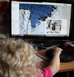
 It was by complete mistake that we came across one of my daughter’s favorite rainy day learning tools. My husband was looking something up on Google Earth and Sweetness became suddenly enthralled. Soon we were showing her our house, then cool places around the country. Before long she was asking about things she’d seen on TV, like penguins and leopard seals, so off we flew on Google Earth to Antarctica and, voila, lots of photos of both animals.
Something simple and free to download has resulted in hours of educational entertainment for the kids.
 For instance, the kids love Penguins of Madagascar. We opened Google Earth, showed them Africa and Madagascar, then zoomed into the island, clicking on image icons to open photos. We do this again when Mommy or Daddy are gone (Hubby showed Sweetness Dallas while I was there for Heli-Expo). And we’re doing it now for our planned summer trip to Yellowstone, zooming in to show the kids the sites, while also establishing an understanding of geography – the Earth is round, places around the world look different, and it’s all connected on our planet.
Another time the kids saw images and models of the Space Shuttle this past year in the Museum of Flight here in Seattle. Additionally, Sweetness has a puzzle of the U.S. that includes an image in each state. Florida’s is the Space Shuttle. Sweetness asked Hubby one day to show her Florida and the Space Shuttle. In a few clicks we zoomed in on Cape Canaveral and sure enough, hundreds of photos of rockets and the shuttle on the launch pad as well as launching were available for her to see. She can now open the program and typically zooms into the Cape herself to look at those photos. Her understanding of places on our planet is exploding.
If you’re not intimately familiar with Google Earth, I highly recommend it. Not only is it helpful for planning trips, but the photos users have posted all over the world create wonderful learning opportunities for all of us.
What’s more, my little 4 year old has gotten rather adept at operating the mouse to operate the program, learning how to zoom in and out, spin the globe, click on image icons so she can see the photos, and can even pick our state out from the world map now.
So if you’re looking for a great rainy day educational opportunity that develops valuable life skills (using the computer) as well as feeding kids’ curiosity about the world we live in, give Google Maps a spin.
Disclaimer: Google didn’t pay me for this post. Hubby downloaded the program and used it himself, which lead to us finding by accident how much our kids could learn just playing with it. Thanks Google!


{ 1 comment }
We LOVE Google Earth. It is more than cool. And I like to look at the oceans and see the undersea mountains through the water. And how cool is it that Sweetness is becoming so adept with the mouse- definitely a skill she’ll need in life. Little Man and I get on the program and look up our house, grandparents houses, aunts and uncles houses, and more. We even looked up a little red lighthouse that was written about in an old children’s story book we read. It’s right next to one of the bridges of NYC. We didn’t know if the lighthouse was real or made up for the story- and then we saw it! It’s real!
Susan recently posted: From Freak Out to Empowerment